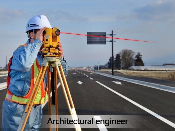
Architectural Engineer Laser Rangefinder Sensor
An Architectural Engineer might use a laser rangefinder sensor for various tasks related to measuring and documenting the physical dimensions of buildings, structures, and construction sites. Here’s an overview of what a laser rangefinder sensor is and how it can be useful in architectural engineering:
What is a Laser Rangefinder Sensor?
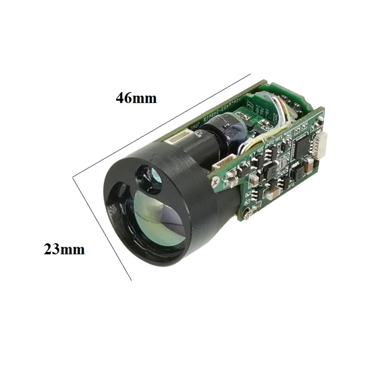
A laser rangefinder (LRF) is a distance device that uses a laser beam to measure the distance to a target. It works by emitting a laser pulse and measuring the time it takes for the pulse to reflect off the target and return to the long range distance sensor. This time-of-flight measurement is then used to calculate the distance.
Key Features of Laser Rangefinder Sensors
1. Accuracy: High precision measurements, often within millimeters.
2. Range: Capable of measuring distances from a few centimeters to several hundred meters.
3. Speed: Quick measurement times, allowing for rapid data collection.
4. Portability: Many models are handheld and easy to carry around.
5. Durability: Designed to withstand harsh environments and rough handling.
6. Data Storage and Transfer: Some models can store measurements and transfer them to a computer or mobile device via RS485, RS232, Bluetooth, USB, or other methods.
Email: sales@seakeda.com
WeChat: 86-18302879423
Applications in Architectural Engineering
1. Site Surveying:
Measuring Distances: Quickly and accurately measure distances between points on a construction site.
Elevation and Slope Measurement: Determine the elevation and slope of terrain to plan drainage and grading.
2. Building Layout:
Dimension Verification: Ensure that the actual dimensions of a building match the design specifications.
Alignment and Leveling: Check the alignment and levelness of walls, floors, and ceilings during construction.
3. Renovation and Retrofitting:
As-Built Documentation: Create accurate as-built drawings of existing structures for renovation projects.
Space Planning: Measure and document the dimensions of rooms and spaces for interior design and space planning.
4. Structural Analysis:
Deformation Monitoring: Monitor the deformation of structures over time to ensure safety and stability.
Crack and Defect Detection: Identify and measure cracks and defects in structures for maintenance and repair.
5. BIM (Building Information Modeling):
Data Integration: Integrate precise measurements into BIM models for more accurate and detailed digital representations of buildings.
Clash Detection: Use the data to detect potential clashes between different building systems (e.g., HVAC, electrical, plumbing) before construction begins.
Choosing the Right Laser Rangefinder Module
When selecting a outdoor laser rangefinder module for architectural engineering, consider the following factors:
1. Measurement Range and Accuracy: Choose a model that meets the specific needs of your project.
2. Environmental Conditions: Select a mini rangefinder that can operate in the conditions you will encounter (e.g., outdoor, dusty, wet).
3. Battery Life and Durability: Ensure the device has a long battery life and is built to last in rugged environments.
4. Connectivity and Data Management: Look for features like Bluetooth or Wi-Fi connectivity, and the ability to export data to software tools you use.
Conclusion
A laser rangefinder sensor is a valuable tool for architectural engineers, providing quick, accurate, and reliable measurements that can enhance the precision and efficiency of their work. Whether it’s for site surveying, building layout, or structural analysis, an industrial laser rangefinder can help ensure that projects are completed to the highest standards.